Slavic Marches
I’ve always enjoyed maps. A good map can convey information in an incredibly concise way. And they are of course useful for navigation.
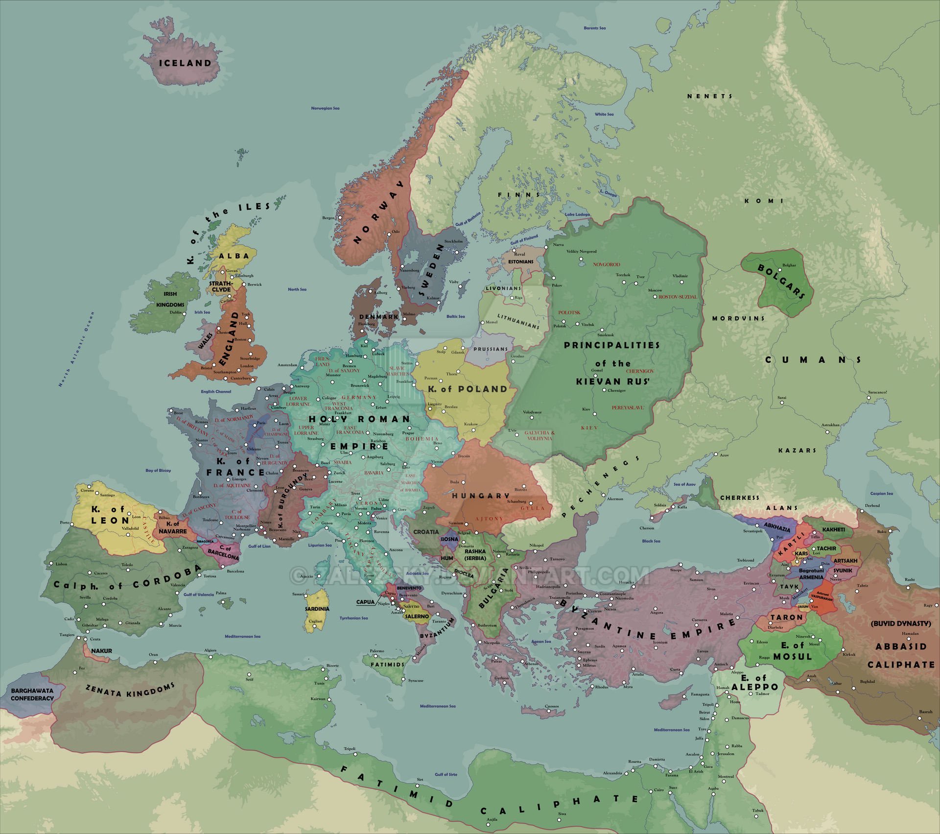
However, you do need to be careful. As an example, I saw this map that purported to show the political divisions of Europe circa 1000 A.D. All of the white dots are settlements of some type, and at least from a distance it looks like those settlements are pretty even distributed in Central Europe. However, I know that some of those cities didn’t exist at the time the map purports to represent.
I’ll zoom in to one area to show you what I mean.
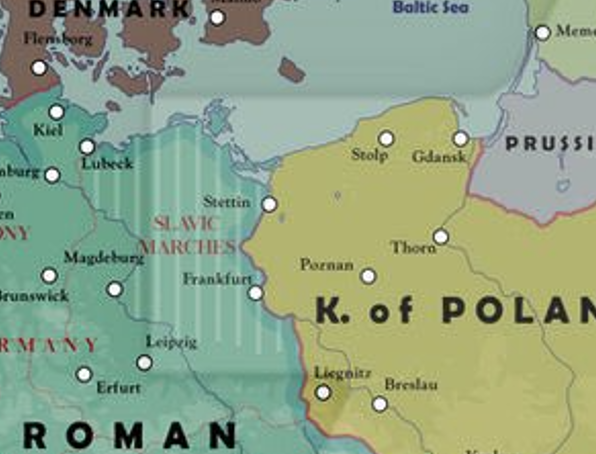
The Slavic Marches
The area I zoomed in to is the Northern March or Slavic March, march being a border region, often unsettled and lawless. At the beginning of the 11th century, this area certainly was! Let’s see what Rick Stump had to say about this area:
Well within recorded history the portions of Germany East of the Elbe and Saale Rivers were as sparsely populated as remote Siberia or Alaska. That's right - in the year 1,014 A.D. what is now the Berlin/Brandenburg Metropolitan Area, home to 4.5 million people, was a howling wilderness populated only by bears and perhaps a seasonal camp for a small clan of Wends. At that time if you had travelled East from the brand-new, just founded settlement of Leipsig you could travel for over 200 miles (often in heavy forest) before you reached the small town of Posen in Poland, a small place with a small fort. In between were just a handful of brave hunters and wilderness.
Rick was talking about this because the standard D&D setting is much like 11th century Germany east of the Elbe, the edge of civilization, a dangerous place to be sure, but also one where the bold and lucky can make a name for themselves.
If you look at this map, you can see Frankfurt in between Leipzig and Posen (Poznań). That would be Frankfurt an der Oder, not the better known and bigger Frankfurt to the west. Except there was no settlement here until the 13th century! This was part of a process known as the Ostsiedlung.
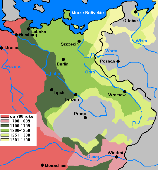
Stages of German eastern settlement, 700-1400
By Mix321 - Die bäuerliche deutsche Ostsiedlung, GFDL, https://commons.wikimedia.org/w/index.php?curid=10852740
The population of this wilderness took centuries. Maybe some German prince asserted his borders went as far as the map at the top shows, but the reality was very different. This kind of thing is pretty common, and you just need to know enough history to spot the obvious mistake.
Comments ()